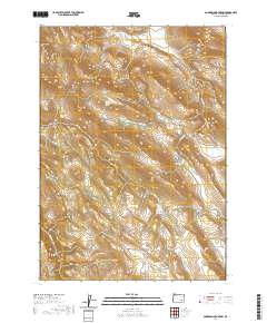
2020 Map of Anderson Mountain
USGS Topo · Published 2020About this map
Anderson Mtn and Riddle Mtn define this high-altitude landscape in eastern Oregon, where seasonal drainages and isolated springs provided essential water for range management. The map reveals a network of natural catchments and naming conventions that speak to the region's ranching heritage, including Buck Pasture and the expansive Orejana Flat. Water sources like Louie Hughes Spring and Upper Paul Creek Spring are critical markers in this arid environment, while the presence of Three Lakes suggests unique hydrologic depressions atop the ridges. Access is limited to the remote Virginia Valley Rd and Anderson Valley Rd, which traverse the high ground between Anderson Valley and the surrounding peaks like Little Riddle Mtn. This document serves as a detailed record of the drainage patterns for Buster Cr and Paul Cr as they existed in the early twenty-first century.
Find a feature on this map
29 named features on this map. Tap any name to fly to it.
Don’t see what you’re looking for? This feature index may not catch every label — zoom into the map to look around manually.
Map Details
Editions of this 2020 Anderson Mountain Map
This is the sole edition of this map. No revisions or reprints were ever made.
Other maps of this area

1955 · Burns
USGS Topo · 1:250,000

1955 · Adel
USGS Topo · 1:250,000

1957 · Adel
USGS Topo · 1:250,000

1958 · Burns
USGS Topo · 1:250,000

1958 · Adel
USGS Topo · 1:250,000

1959 · Burns
USGS Topo · 1:250,000

1962 · Adel
USGS Topo · 1:250,000

1967 · Happy Valley
USGS Topo · 1:24,000

1967 · Adobe Flat
USGS Topo · 1:24,000

1968 · Poison Springs
USGS Topo · 1:24,000