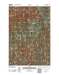
2011 Map of Andies Prairie
USGS Topo · Published 2011About this map
Andies Prairie and its surrounding high-elevation meadows define this portion of Umatilla County, where the headwaters of several critical drainages originate. The landscape is characterized by a series of prominent basaltic fingers including Ninemile Ridge, Pedro Ridge, and Glenn Ridge, which separate the deeply carved canyons of Phillips Creek and Pedro Creek. In the northern section, the North Fork Umatilla River winds through the terrain, overseen by the Umatilla Brakes Viewpoint. This 2011 survey reflects the modern management of these public lands, highlighting recreational infrastructure like the Woodland Sno-Park alongside numerous named water sources such as Portuguese Spring, Will Rogers Spring, and Picnic Spring. The intricate network of forest roads shown provides a clear picture of how this high-country terrain is accessed for both timber management and seasonal recreation.
Find a feature on this map
28 named features on this map. Tap any name to fly to it.
Don’t see what you’re looking for? This feature index may not catch every label — zoom into the map to look around manually.
Map Details
Editions of this 2011 Andies Prairie Map
This is the sole edition of this map. No revisions or reprints were ever made.
Other maps of this area

1953 · Pendleton
USGS Topo · 1:250,000

1955 · Grangeville
USGS Topo · 1:250,000

1956 · Pendleton
USGS Topo · 1:250,000

1959 · Grangeville
USGS Topo · 1:250,000

1963 · Andies Prairie
USGS Topo · 1:24,000

1963 · Sanderson Spring
USGS Topo · 1:24,000

1963 · Bingham Springs
USGS Topo · 1:24,000

1963 · Tollgate
USGS Topo · 1:24,000

1963 · Blalock Mountain
USGS Topo · 1:24,000

1964 · Partridge Creek
USGS Topo · 1:24,000