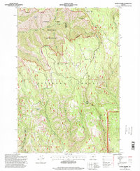
1995 Map of Andies Prairie
USGS Topo · Published 1998About this map
Umatilla National Forest occupies this high-elevation landscape in the Blue Mountains, defined by sharp ridges and deep river canyons. The map shows a transition from managed forest land to the protected North Fork Umatilla Wilderness, which follows the steep descent of the North Fork Umatilla River and its many tributaries like Woodward Creek and Johnson Creek. At the northern edge, recreational and utility sites such as Woodland Snowpark and the Spout Springs Electronic Site reflect the modern human footprint on these ridges.
Find a feature on this map
38 named features on this map. Tap any name to fly to it.
Don’t see what you’re looking for? This feature index may not catch every label — zoom into the map to look around manually.
Map Details
Editions of this 1995 Andies Prairie Map
This is the sole edition of this map. No revisions or reprints were ever made.
Other maps of this area

1953 · Pendleton
USGS Topo · 1:250,000

1955 · Grangeville
USGS Topo · 1:250,000

1956 · Pendleton
USGS Topo · 1:250,000

1959 · Grangeville
USGS Topo · 1:250,000

1963 · Andies Prairie
USGS Topo · 1:24,000

1963 · Sanderson Spring
USGS Topo · 1:24,000

1963 · Bingham Springs
USGS Topo · 1:24,000

1963 · Tollgate
USGS Topo · 1:24,000

1963 · Blalock Mountain
USGS Topo · 1:24,000

1964 · Partridge Creek
USGS Topo · 1:24,000