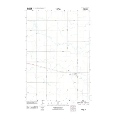
2012 Map of Andover
USGS Topo · Published 2012About this map
The town of Andover is situated in the south-central portion of this Day County landscape, where the local street grid intersects with the east-west corridor of Railroad Ave. This 2012 survey illustrates the organized section lines characteristic of the eastern South Dakota prairie, with a network of numbered avenues and streets like 414th Ave and 135th St facilitating agricultural transport. For those researching local history or genealogy, the map identifies key burial grounds north of the town center, including the Andover Cem and All Saints Catholic Cem. The surrounding terrain is marked by a complex system of seasonal watercourses and drainage patterns that weave between the rigid grid of rural roads, showing the persistent influence of the natural hydrology on the developed township layout.
Find a feature on this map
22 named features on this map. Tap any name to fly to it.
Don’t see what you’re looking for? This feature index may not catch every label — zoom into the map to look around manually.
Map Details
Editions of this 2012 Andover Map
This is the sole edition of this map. No revisions or reprints were ever made.
Other maps of this area

1895 · Aberdeen
USGS Topo · 1:125,000

1896 · Columbia
USGS Topo · 1:125,000

1952 · Huffton
USGS Topo · 1:24,000

1953 · Milbank
USGS Topo · 1:250,000

1954 · Groton
USGS Topo · 1:24,000

1954 · Ferney
USGS Topo · 1:24,000

1954 · Aberdeen
USGS Topo · 1:250,000

1956 · Aberdeen
USGS Topo · 1:250,000

1958 · Milbank
USGS Topo · 1:250,000

1958 · Andover
USGS Topo · 1:24,000