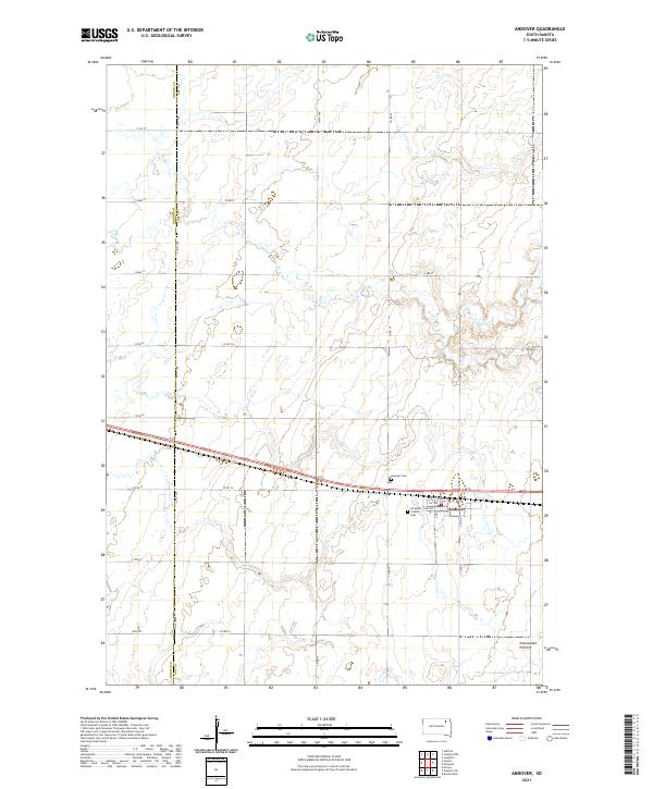
2021 Map of Andover
USGS Topo · Published 2021About this map
Andover serves as the focal point of this Day County landscape, situated along the eastern edge of the Brown Co Day Co boundary line. The town's layout is centered around the transport corridor of Railroad Ave and 1st Ave, showing the organized grid of a prairie settlement. Religious and community heritage is evident in the presence of All Saints Catholic church and its associated All Saints Catholic Cem, alongside the Andover Cem located just north of the main settlement. The terrain transitions into the distinct geographic formation of the Coteau des Prairies in the southeast, characterized by the subtle elevation changes of the glaciated plateau. A dense network of section line roads, such as 412th Ave and 135th St, illustrates the persistent rectangular survey system that has governed the South Dakota plains for generations.
Find a feature on this map
32 named features on this map. Tap any name to fly to it.
Don’t see what you’re looking for? This feature index may not catch every label — zoom into the map to look around manually.
Map Details
Editions of this 2021 Andover Map
This is the sole edition of this map. No revisions or reprints were ever made.
Other maps of this area

1895 · Aberdeen
USGS Topo · 1:125,000

1896 · Columbia
USGS Topo · 1:125,000

1952 · Huffton
USGS Topo · 1:24,000

1953 · Milbank
USGS Topo · 1:250,000

1954 · Groton
USGS Topo · 1:24,000

1954 · Ferney
USGS Topo · 1:24,000

1954 · Aberdeen
USGS Topo · 1:250,000

1956 · Aberdeen
USGS Topo · 1:250,000

1958 · Milbank
USGS Topo · 1:250,000

1958 · Andover
USGS Topo · 1:24,000