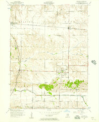
1953 Map of Andover
USGS Topo · Published 1957About this map
The Edwards River meanders across this rural Henry County landscape, anchoring a region defined by scattered agricultural settlements and local institutions in the early 1950s. The village of Andover serves as a local hub, featuring the Jenny Lind Church and a Home for children on its outskirts. To the north and west, the towns of Orion, Osco, and Lynn Center are linked by the Chicago Rock Island and Pacific railroad, which cuts a straight path through the township boundaries of Lynn and Western.
Find a feature on this map
21 named features on this map. Tap any name to fly to it.
Don’t see what you’re looking for? This feature index may not catch every label — zoom into the map to look around manually.
Map Details
Editions of this 1953 Andover Map
2 editions found
Other maps of this area

1931 · Galva
USGS Topo · 1:48,000

1934 · Geneseo
USGS Topo · 1:62,500

1937 · Orion
USGS Topo · 1:62,500

1940 · Galva
USGS Topo · 1:62,500

1944 · Galva
USGS Topo · 1:62,500

1947 · Woodhull
USGS Topo · 1:62,500

1949 · Coal Valley
USGS Topo · 1:24,000
1953 · Coal Valley
USGS Topo · 1:24,000

1953 · Nekoma
USGS Topo · 1:24,000

1953 · Woodhull
USGS Topo · 1:24,000