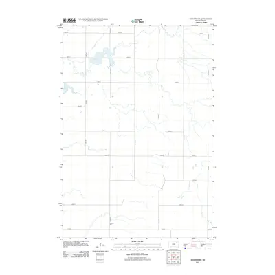
2012 Map of Andover SW
USGS Topo · Published 2012About this map
Scotland Cem sits as a lonely marker in the southern landscape of this part of Brown County, where the agricultural grid is deeply established. This 2012 survey captures the prairie terrain of Bates Township defined by the slow, winding path of Mud Cr. The northern sections are dominated by larger water bodies, specifically Amsden Lake and the smaller Pigors Lake, which break the uniformity of the section lines and gravel roads. The transport network is purely rectilinear, consisting of numbered streets and avenues like 139th St and 414th Ave, reflecting the systematic settlement and land management of the South Dakota plains. This map preserves the 21st-century state of these rural crossroads and the hydrology of the Mud Creek basin before further changes to land use or drainage occurred.
Find a feature on this map
19 named features on this map. Tap any name to fly to it.
Don’t see what you’re looking for? This feature index may not catch every label — zoom into the map to look around manually.
Map Details
Editions of this 2012 Andover SW Map
This is the sole edition of this map. No revisions or reprints were ever made.
Other maps of this area

1894 · Conde
USGS Topo · 1:62,500

1895 · Aberdeen
USGS Topo · 1:125,000

1953 · Milbank
USGS Topo · 1:250,000

1954 · Groton
USGS Topo · 1:24,000

1954 · Ferney
USGS Topo · 1:24,000

1954 · Aberdeen
USGS Topo · 1:250,000

1956 · Aberdeen
USGS Topo · 1:250,000

1958 · Milbank
USGS Topo · 1:250,000
1958 · Conde
USGS Topo · 1:24,000

1958 · Andover
USGS Topo · 1:24,000