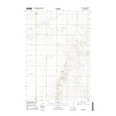
2015 Map of Andover SW
USGS Topo · Published 2015About this map
The Coteau des Prairies rises prominently across this prairie landscape on the border of Brown and Day counties. This glacial upland feature dominates the eastern half of the sheet, providing a stark topographical contrast to the flatter western section. Water management and drainage define the lowland areas, where Mud Cr meanders toward Amsden Lake and the smaller Pigors Lake sits near the western edge. A precise grid of section roads, including 139th St and 412th Ave, organizes the agricultural territory. For those tracing local history, the Scotland Cem is a significant landmark situated in the southwestern portion of the quadrangle, serving as a quiet witness to the generations who farmed this portion of the Dakotas.
Find a feature on this map
26 named features on this map. Tap any name to fly to it.
Don’t see what you’re looking for? This feature index may not catch every label — zoom into the map to look around manually.
Map Details
Editions of this 2015 Andover SW Map
This is the sole edition of this map. No revisions or reprints were ever made.
Other maps of this area

1894 · Conde
USGS Topo · 1:62,500

1895 · Aberdeen
USGS Topo · 1:125,000

1953 · Milbank
USGS Topo · 1:250,000

1954 · Groton
USGS Topo · 1:24,000

1954 · Ferney
USGS Topo · 1:24,000

1954 · Aberdeen
USGS Topo · 1:250,000

1956 · Aberdeen
USGS Topo · 1:250,000

1958 · Milbank
USGS Topo · 1:250,000
1958 · Conde
USGS Topo · 1:24,000

1958 · Andover
USGS Topo · 1:24,000