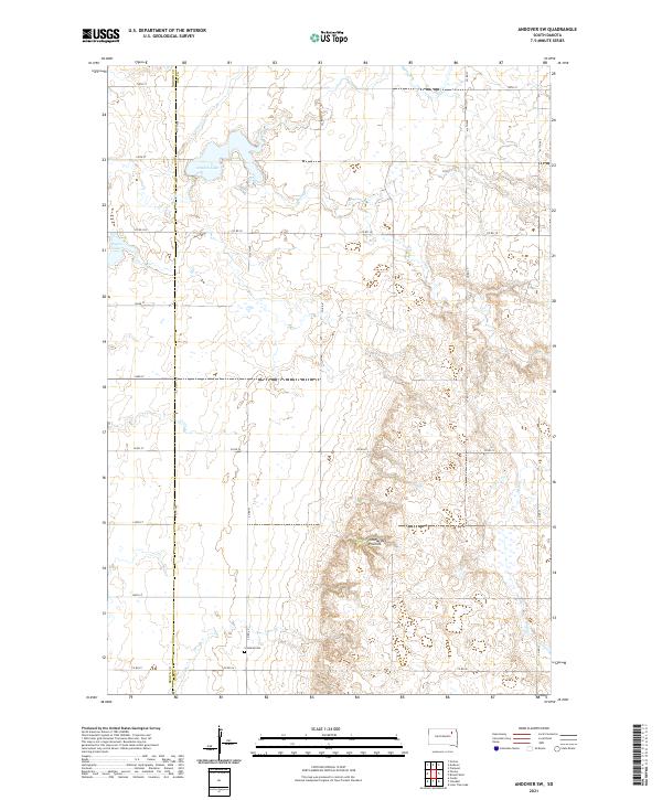
2021 Map of Andover SW
USGS Topo · Published 2021About this map
The Coteau des Prairies upland plateau dominates the eastern landscape of this South Dakota region, where the rise in elevation meets the drainage of Mud Cr. The terrain is defined by the sharp jurisdictional divide of Brown Co and Day Co, a boundary that separates the flatter western plains from the rugged glacial drift of the coteau. In the northwestern corner, Amsden Lake and Pigors Lake provide significant water features in an area otherwise characterized by section-line roads and sparse prairie settlement.
Find a feature on this map
28 named features on this map. Tap any name to fly to it.
Don’t see what you’re looking for? This feature index may not catch every label — zoom into the map to look around manually.
Map Details
Editions of this 2021 Andover SW Map
This is the sole edition of this map. No revisions or reprints were ever made.
Other maps of this area

1894 · Conde
USGS Topo · 1:62,500

1895 · Aberdeen
USGS Topo · 1:125,000

1953 · Milbank
USGS Topo · 1:250,000

1954 · Groton
USGS Topo · 1:24,000

1954 · Ferney
USGS Topo · 1:24,000

1954 · Aberdeen
USGS Topo · 1:250,000

1956 · Aberdeen
USGS Topo · 1:250,000

1958 · Milbank
USGS Topo · 1:250,000
1958 · Conde
USGS Topo · 1:24,000

1958 · Andover
USGS Topo · 1:24,000