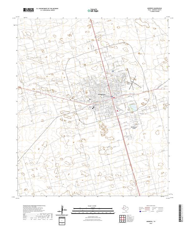
2022 Map of Andrews
USGS Topo · Published 2022About this map
The West Texas city of Andrews serves as the central hub of this Andrews County study, defined by its organized grid and role as a local seat of government. The Andrews County Courthouse stands at the heart of the settlement, surrounded by a network of thoroughfares including E Broadway St and W Broadway St. The geography here transitions from the dense residential blocks of the city center to the emerging community at McKinney Acres further south. Local history and genealogy are well-represented by the documented locations of the Andrews County Old Cem and Andrews County West Cem. Transportation and infrastructure are prominent themes, with Ranch Rd 87 and Ranch Rd 703 providing regional access, while the Andrews County Airport indicates the area's importance as a regional aviation point in the Permian Basin region.
Find a feature on this map
28 named features on this map. Tap any name to fly to it.
Don’t see what you’re looking for? This feature index may not catch every label — zoom into the map to look around manually.
Map Details
Editions of this 2022 Andrews Map
This is the sole edition of this map. No revisions or reprints were ever made.
Other maps of this area

1954 · Hobbs
USGS Topo · 1:250,000

1958 · Hobbs
USGS Topo · 1:250,000

1963 · Andrews
USGS Topo · 1:24,000

1968 · North Cowden NW
USGS Topo · 1:24,000

1968 · Gardendale NW
USGS Topo · 1:24,000

1968 · Clabber Hill Ranch
USGS Topo · 1:24,000

1971 · Five Wells Ranch NW
USGS Topo · 1:24,000

1971 · Florey
USGS Topo · 1:24,000
1971 · Five Wells Ranch SW
USGS Topo · 1:24,000

1971 · Shafter Lake
USGS Topo · 1:24,000