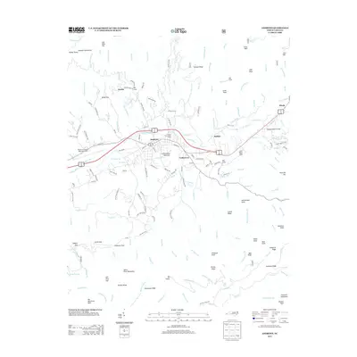
2013 Map of Andrews
USGS Topo · Published 2013About this map
Andrews serves as the central hub of this mountain landscape, situated where the Valley River and Junaluska Cr converge. The layout reveals a mix of transport and civic infrastructure, from the Western Carolina Regional Airport on the western edge to the Georgia State Prison Camp located north of the river. Small settlements like Valleytown, Buffalo, and Hardin dot the lower elevations, while the terrain rises sharply into the surrounding peaks. To the south and east, the map details a complex network of ridges and knobs, including Leatherwood Mountain, Rattlesnake Knob, and Collett Ridge. Numerous family-named coves and gaps, such as John West Cove and Granny Squirrel Gap, indicate long-standing local ties to specific drainages and mountain passes. The presence of the Rail Cove Br suggests the importance of rail transport in navigating this western North Carolina valley.
Find a feature on this map
176 named features on this map. Tap any name to fly to it.
Don’t see what you’re looking for? This feature index may not catch every label — zoom into the map to look around manually.
Map Details
Editions of this 2013 Andrews Map
This is the sole edition of this map. No revisions or reprints were ever made.
Other maps of this area

1933 · Bushnell
USGS Topo · 1:62,500

1935 · Peachtree
USGS Topo · 1:24,000

1935 · Robbinsville
USGS Topo · 1:24,000

1935 · Shooting Creek
USGS Topo · 1:24,000

1935 · Topton
USGS Topo · 1:24,000

1935 · Marble
USGS Topo · 1:24,000

1935 · Wayah Bald
USGS Topo · 1:48,000

1935 · Santeetlah Creek
USGS Topo · 1:24,000

1935 · Andrews
USGS Topo · 1:24,000
1935 · Hayesville
USGS Topo · 1:24,000