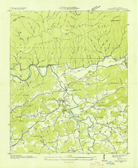
1935 Map of Hayesville
USGS Topo · Published 1935About this map
Hayesville serves as the central hub of this Clay County landscape, situated where the Hiwassee River and its numerous tributaries converge. The terrain is defined by the massive Tusquitee Mountains and Nantahala National Forest to the north, while the valley below is a dense network of small communities and rural institutions. The social geography of the mid-1930s is mapped through several country churches and schools, such as Tusquitee Ch, Oak Forest Ch, and the Hayesville Sch.
Find a feature on this map
117 named features on this map. Tap any name to fly to it.
Don’t see what you’re looking for? This feature index may not catch every label — zoom into the map to look around manually.
Map Details
Editions of this 1935 Hayesville Map
This is the sole edition of this map. No revisions or reprints were ever made.
Other maps of this area

1886 · Dahlonega
USGS Topo · 1:125,000

1892 · Dahlonega
USGS Topo · 1:125,000

1896 · Dahlonega
USGS Topo · 1:125,000

1903 · Dahlonega
USGS Topo · 1:125,000

1935 · Peachtree
USGS Topo · 1:24,000

1935 · Osborn
USGS Topo · 1:24,000

1935 · Shooting Creek
USGS Topo · 1:24,000

1935 · Topton
USGS Topo · 1:24,000

1935 · Marble
USGS Topo · 1:24,000

1935 · Wayah Bald
USGS Topo · 1:48,000