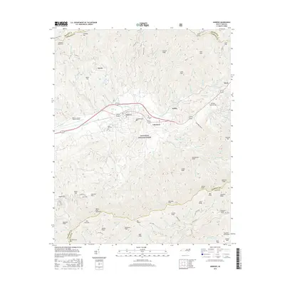
2016 Map of Andrews
USGS Topo · Published 2016About this map
The Valley River corridor serves as the primary artery through this portion of Cherokee County, where the town of Andrews and the adjacent settlement of Valleytown occupy the relatively level valley floor. This topography is sharply defined by the surrounding Snowbird Mountains and Tusquitee Mountains, which form the northern and southern bounds of the valley. Significant portions of the landscape fall within the Nantahala National Forest, preserving the wooded ridges and numerous drainage basins like John West Cove.
Find a feature on this map
128 named features on this map. Tap any name to fly to it.
Don’t see what you’re looking for? This feature index may not catch every label — zoom into the map to look around manually.
Map Details
Editions of this 2016 Andrews Map
This is the sole edition of this map. No revisions or reprints were ever made.
Other maps of this area

1933 · Bushnell
USGS Topo · 1:62,500

1935 · Peachtree
USGS Topo · 1:24,000

1935 · Robbinsville
USGS Topo · 1:24,000

1935 · Shooting Creek
USGS Topo · 1:24,000

1935 · Topton
USGS Topo · 1:24,000

1935 · Marble
USGS Topo · 1:24,000

1935 · Wayah Bald
USGS Topo · 1:48,000

1935 · Santeetlah Creek
USGS Topo · 1:24,000

1935 · Andrews
USGS Topo · 1:24,000
1935 · Hayesville
USGS Topo · 1:24,000