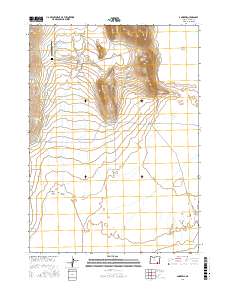
2017 Map of Andrews
USGS Topo · Published 2017About this map
The high desert landscape of Harney County is defined here by the stark contrast between the Alvord Desert floor and the rising elevation of Serrano Point. In the early 21st century, the small settlement of Andrews remains a focal point of this remote basin, accompanied by a local Cem and the Wildhorse Valley Airport. The map documents a complex water system vital to this arid region, including Alvord Lake and numerous drainage features like Spring Cr, Miranda Cr, and the engineered Kueny Ditch.
Find a feature on this map
28 named features on this map. Tap any name to fly to it.
Don’t see what you’re looking for? This feature index may not catch every label — zoom into the map to look around manually.
Map Details
Editions of this 2017 Andrews Map
This is the sole edition of this map. No revisions or reprints were ever made.
Other maps of this area

1955 · Adel
USGS Topo · 1:250,000

1957 · Adel
USGS Topo · 1:250,000

1958 · Adel
USGS Topo · 1:250,000

1962 · Adel
USGS Topo · 1:250,000

1968 · Alvord Hot Springs
USGS Topo · 1:24,000

1968 · Ankle Creek
USGS Topo · 1:24,000

1971 · Andrews
USGS Topo · 1:24,000

1971 · V Lake
USGS Topo · 1:24,000

1971 · Fields
USGS Topo · 1:24,000

1971 · Borax Lake
USGS Topo · 1:24,000