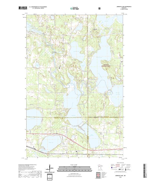
2022 Map of Andrusia Lake
USGS Topo · Published 2022About this map
Andrusia Lake and Wolf Lake dominate this northern landscape where the Mississippi River connects a chain of significant water bodies. Situated within the Chippewa National Forest, the area reflects a transition from protected timberland to lakeside settlements. Local history is anchored by the Frohn East Side Cem and the Farris Cem, providing clear geographic markers for genealogical research. The presence of the Leech Lake Tribal College near Little Wolf Lake highlights the region's contemporary educational and cultural significance. Surveyed paths like the Old Crossing Trl and the Mississippi River Trl suggest long-established transportation routes that followed the natural contours of the river and lakeshore, while the Island Point Canoe Landing underscores the enduring recreational and functional relationship between the community and the water.
Find a feature on this map
115 named features on this map. Tap any name to fly to it.
Don’t see what you’re looking for? This feature index may not catch every label — zoom into the map to look around manually.
Map Details
Editions of this 2022 Andrusia Lake Map
This is the sole edition of this map. No revisions or reprints were ever made.
Other maps of this area

1920 · Buena Vista
USGS Topo · 1:62,500

1954 · Bemidji
USGS Topo · 1:250,000

1957 · Bemidji
USGS Topo · 1:250,000

1958 · Bemidji
USGS Topo · 1:250,000

1968 · Guthrie
USGS Topo · 1:24,000

1968 · Bemidji East
USGS Topo · 1:24,000

1972 · Turtle River Lake
USGS Topo · 1:24,000
1972 · Pimushe Lake
USGS Topo · 1:24,000

1972 · Pike Bay
USGS Topo · 1:24,000
1972 · Turtle River
USGS Topo · 1:24,000