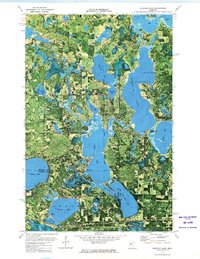
1972 Map of Andrusia Lake
USGS Topo · Published 1974About this map
The Mississippi River winds through a dense network of glacial basins where the boundaries of Beltrami, Hubbard, and Cass counties converge. This orthophotomap, derived from 1969 aerial photography, reveals the 1970s character of the northern Minnesota lake country before significant shoreline development altered these woods. The vast waters of Andrusia Lake and Big Lake dominate the northeastern portion, bordered by the Chippewa National Forest and Sugar Bush Buena Vista State Forest. To the south, the Burlington Northern railroad cuts a straight line across the landscape, passing just below Midge Lake and Little Midge Lake. Local historical details include the Minne-Wa-Kan Camp on the eastern shore of Andrusia Lake and the small settlement of Andrusia, alongside specialized areas like the Wolf Lake Wildlife Management Area.
Find a feature on this map
33 named features on this map. Tap any name to fly to it.
Don’t see what you’re looking for? This feature index may not catch every label — zoom into the map to look around manually.
Map Details
Editions of this 1972 Andrusia Lake Map
This is the sole edition of this map. No revisions or reprints were ever made.
Other maps of this area

1920 · Buena Vista
USGS Topo · 1:62,500

1954 · Bemidji
USGS Topo · 1:250,000

1957 · Bemidji
USGS Topo · 1:250,000

1958 · Bemidji
USGS Topo · 1:250,000

1968 · Guthrie
USGS Topo · 1:24,000

1968 · Bemidji East
USGS Topo · 1:24,000

1972 · Turtle River Lake
USGS Topo · 1:24,000
1972 · Pimushe Lake
USGS Topo · 1:24,000

1972 · Pike Bay
USGS Topo · 1:24,000
1972 · Turtle River
USGS Topo · 1:24,000