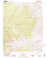
1984 Map of Angel Peak
USGS Topo · Published 1984About this map
The Spring Mountains define this high-elevation landscape, where the terrain rises toward Angel Peak and Fletcher Peak. In the early 1980s, the area served as a significant recreational and institutional corridor within the Toiyabe National Forest. The map documents a blend of public service and outdoor activity, featuring the Spring Mtn Youth Camp, the Kyle Canyon Ranger Station, and several established sites like the Mahogany Grove Picnic Area and Hilltop Campground.
Find a feature on this map
33 named features on this map. Tap any name to fly to it.
Don’t see what you’re looking for? This feature index may not catch every label — zoom into the map to look around manually.
Map Details
Editions of this 1984 Angel Peak Map
2 editions found
Other maps of this area

1907 · Las Vegas
USGS Topo · 1:250,000

1908 · Las Vegas
USGS Topo · 1:250,000

1952 · Corn Creek Springs
USGS Topo · 1:62,500

1952 · Blue Diamond
USGS Topo · 1:62,500

1954 · Las Vegas
USGS Topo · 1:250,000

1957 · Las Vegas
USGS Topo · 1:250,000

1957 · Charleston Peak
USGS Topo · 1:62,500

1957 · Mountain Springs
USGS Topo · 1:62,500

1959 · Las Vegas
USGS Topo · 1:250,000

1962 · Las Vegas
USGS Topo · 1:250,000