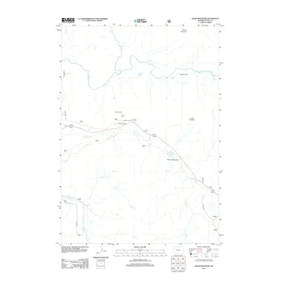
2012 Map of Angle Mountain
USGS Topo · Published 2012About this map
Togwotee Lodge serves as a central landmark in this high-elevation landscape of Teton County, where the Continental Divide influences the drainage patterns of several significant waterways. The terrain is defined by prominent peaks such as Angle Mountain and Terrace Mountain, with the valley floors shaped by the Buffalo Fork and its northern and southern branches. This 2012 survey illustrates the modern road and trail infrastructure providing access to the backcountry, including the Angles Trailhead and the Togwotee Overlook. The mapping detail emphasizes the hydrological complexity of the area, tracing the winding paths of Blackrock Cr through Blackrock Meadows and the headwaters of N Fork Spread Cr and Grizzly Cr. It is a landscape primarily defined by its natural topography and seasonal access points rather than permanent urban settlements.
Find a feature on this map
17 named features on this map. Tap any name to fly to it.
Don’t see what you’re looking for? This feature index may not catch every label — zoom into the map to look around manually.
Map Details
Editions of this 2012 Angle Mountain Map
This is the sole edition of this map. No revisions or reprints were ever made.
Other maps of this area

1902 · Mt Leidy
USGS Topo · 1:125,000

1955 · Driggs
USGS Topo · 1:250,000

1958 · Driggs
USGS Topo · 1:250,000

1962 · Driggs
USGS Topo · 1:250,000

1965 · Green Mountain
USGS Topo · 1:24,000
1965 · Lava Mountain
USGS Topo · 1:24,000

1965 · Rosies Ridge
USGS Topo · 1:24,000

1965 · Tripod Peak
USGS Topo · 1:24,000
1965 · Togwotee Pass
USGS Topo · 1:24,000
1965 · Angle Mountain
USGS Topo · 1:24,000