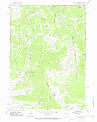
1965 Map of Lava Mountain
USGS Topo · Published 1968About this map
The Continental Divide winds through this high-altitude landscape, separating the headwaters of the Wind River from the westward-flowing tributaries of the Snake River system. Situated at the boundary of Teton and Fremont counties, the terrain is defined by prominent peaks and mountain basins that reflect the wilderness character of the mid-1960s. Brooks Lake Lodge stands as the primary hub of human activity in the northeast, positioned near the waters of Wind River Lake and beneath the shadow of Sublette Peak.
Find a feature on this map
42 named features on this map. Tap any name to fly to it.
Don’t see what you’re looking for? This feature index may not catch every label — zoom into the map to look around manually.
Map Details
Editions of this 1965 Lava Mountain Map
2 editions found
Other maps of this area

1902 · Mt Leidy
USGS Topo · 1:125,000

1905 · Younts Peak
USGS Topo · 1:125,000

1907 · Younts Peak
USGS Topo · 1:125,000

1955 · Driggs
USGS Topo · 1:250,000

1955 · Thermopolis
USGS Topo · 1:250,000

1956 · Fish Lake
USGS Topo · 1:24,000

1956 · Kisinger Lakes
USGS Topo · 1:24,000
1956 · Dundee Meadows
USGS Topo · 1:24,000

1958 · Driggs
USGS Topo · 1:250,000

1958 · Thermopolis
USGS Topo · 1:250,000