
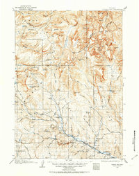
1905 Map of Younts Peak
USGS Topo · Published 1955About this map
Dubois stands at the confluence of the Wind River and Horse Creek, serving as a gateway to the high wilderness of the Absaroka Range and the Teton National Forest at the turn of the twentieth century. The map documents a landscape of early cattle ranching and mineral exploration, evidenced by numerous family-named homesteads such as Burlingham's Ranch and Rocking Chair Ranch, alongside the Clarks Placer Mines and a local Sawmill.
Find a feature on this map
112 named features on this map. Tap any name to fly to it.
Don’t see what you’re looking for? This feature index may not catch every label — zoom into the map to look around manually.
Map Details
Editions of this 1905 Younts Peak Map
2 editions found
Other maps of this area

1885 · Lake
USGS Topo · 1:125,000

1893 · Ishawooa
USGS Topo · 1:125,000

1895 · Ishawooa
USGS Topo · 1:125,000

1895 · Lake
USGS Topo · 1:125,000

1896 · Lake
USGS Topo · 1:125,000

1899 · Ishawooa
USGS Topo · 1:125,000

1901 · Lake
USGS Topo · 1:125,000

1902 · Mt Leidy
USGS Topo · 1:125,000

1904 · Kirwin
USGS Topo · 1:125,000

1906 · Lake
USGS Topo · 1:125,000