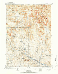
1905 Map of Younts Peak
USGS Topo · Published 1963About this map
The Continental Divide carves through this high-altitude landscape in the Wind River and Absaroka ranges, where early 20th-century life centered on a network of remote ranching outposts and isolated trails. Along the upper Wind River, the settlement of Dubois serves as a lone hub, while the surrounding valley floor is dotted with family holdings including Clarks Ranch, Strivers Ranch, and Green's Ranch. Higher elevations reveal a more transient presence, such as Dundee Camp near the Du Noir Glacier and a Ranger Cabin in the Horse Creek Basin.
Find a feature on this map
114 named features on this map. Tap any name to fly to it.
Don’t see what you’re looking for? This feature index may not catch every label — zoom into the map to look around manually.
Map Details
Editions of this 1905 Younts Peak Map
2 editions found
Other maps of this area

1885 · Lake
USGS Topo · 1:125,000

1893 · Ishawooa
USGS Topo · 1:125,000

1895 · Ishawooa
USGS Topo · 1:125,000

1895 · Lake
USGS Topo · 1:125,000

1896 · Lake
USGS Topo · 1:125,000

1899 · Ishawooa
USGS Topo · 1:125,000

1901 · Lake
USGS Topo · 1:125,000

1902 · Mt Leidy
USGS Topo · 1:125,000

1904 · Kirwin
USGS Topo · 1:125,000

1905 · Younts Peak
USGS Topo · 1:125,000