
1956 Map of Fish Lake
USGS Topo · Published 1958About this map
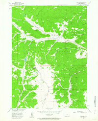
The Continental Divide serves as the topographic anchor of this high-altitude landscape in the mid-1950s, defining the boundary between the Shoshone National Forest and Teton National Forest. The map documents a remote alpine environment where human activity is centered on seasonal mountain work and wilderness travel, evidenced by the Red Flat Cow Camp and an extensive network of pack trails and jeep trails. These paths follow the natural drainage patterns of Warm Spring Creek and Sheridan Creek, illustrating the era's reliance on traditional livestock camps and rugged access routes for forest management and back-country navigation. High-elevation features like Fish Lake Mountain and Fish Lake are surrounded by numerous unnamed springs and small tributaries including Indian Creek and Coyote Creek, which feed the larger basins during the Missouri River Basin development era.
Find a feature on this map
21 named features on this map. Tap any name to fly to it.
Don’t see what you’re looking for? This feature index may not catch every label — zoom into the map to look around manually.
Map Details
Editions of this 1956 Fish Lake Map
5 editions found
Other maps of this area

1902 · Mt Leidy
USGS Topo · 1:125,000

1905 · Younts Peak
USGS Topo · 1:125,000

1907 · Younts Peak
USGS Topo · 1:125,000

1907 · Gros Ventre
USGS Topo · 1:125,000

1909 · Fremont Peak
USGS Topo · 1:125,000

1910 · Gros Ventre
USGS Topo · 1:125,000

1955 · Driggs
USGS Topo · 1:250,000

1955 · Thermopolis
USGS Topo · 1:250,000

1956 · Esmond Park
USGS Topo · 1:24,000

1956 · Warm Spring Mountain
USGS Topo · 1:24,000