
1965 Map of Rosies Ridge
USGS Topo · Published 1968About this map
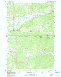
Teton National Forest dominates this mid-1960s landscape, where the braided channels of the Buffalo Fork river wind through high-elevation meadows and timber. The presence of the Blackrock Ranger Station and nearby Hatchet Campground indicates the area's role as a gateway for forestry management and backcountry recreation. To the north, the terrain transitions into the Teton Wilderness, accessible via the Ends Lake Trail and various pack routes that connect the low-lying Turpin Meadow to the higher ridges. The map captures a high-country economy focused on conservation and seasonal use, evidenced by the Turpin Meadow Lodge and various recreation sites. Higher elevations are marked by distinctive landmarks like Baldy Mountain and the elongated spine of Rosies Ridge, while southern drainages such as Spread Creek and Skull Creek feed the larger river system through narrow draws like Wallace Draw.
Find a feature on this map
29 named features on this map. Tap any name to fly to it.
Don’t see what you’re looking for? This feature index may not catch every label — zoom into the map to look around manually.
Map Details
Editions of this 1965 Rosies Ridge Map
2 editions found
Other maps of this area

1902 · Mt Leidy
USGS Topo · 1:125,000

1955 · Driggs
USGS Topo · 1:250,000

1958 · Driggs
USGS Topo · 1:250,000

1962 · Driggs
USGS Topo · 1:250,000

1965 · Davis Hill
USGS Topo · 1:24,000

1965 · Green Mountain
USGS Topo · 1:24,000

1965 · Mount Leidy
USGS Topo · 1:24,000

1965 · Tripod Peak
USGS Topo · 1:24,000
1965 · Whetstone Mountain
USGS Topo · 1:24,000
1965 · Angle Mountain
USGS Topo · 1:24,000