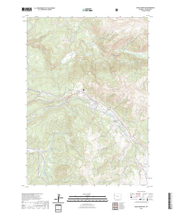
2023 Map of Angle Mountain
USGS Topo · Published 2023About this map
High-altitude hydrology and protected wilderness corridors define this 2023 survey of the northern Teton range. The Snake River Headwaters Wild and Scenic River designation highlights the importance of the North Buffalo Fork and South Buffalo Fork as they converge within the Teton Wilderness. The landscape transitions from these alpine drainage systems into the Teton National Forest to the south, where Angle Mountain and Terrace Mountain overlook the broad expanse of Blackrock Meadows.
Find a feature on this map
29 named features on this map. Tap any name to fly to it.
Don’t see what you’re looking for? This feature index may not catch every label — zoom into the map to look around manually.
Map Details
Editions of this 2023 Angle Mountain Map
This is the sole edition of this map. No revisions or reprints were ever made.
Other maps of this area

1902 · Mt Leidy
USGS Topo · 1:125,000

1955 · Driggs
USGS Topo · 1:250,000

1958 · Driggs
USGS Topo · 1:250,000

1962 · Driggs
USGS Topo · 1:250,000

1965 · Green Mountain
USGS Topo · 1:24,000
1965 · Lava Mountain
USGS Topo · 1:24,000

1965 · Rosies Ridge
USGS Topo · 1:24,000

1965 · Tripod Peak
USGS Topo · 1:24,000
1965 · Togwotee Pass
USGS Topo · 1:24,000
1965 · Angle Mountain
USGS Topo · 1:24,000