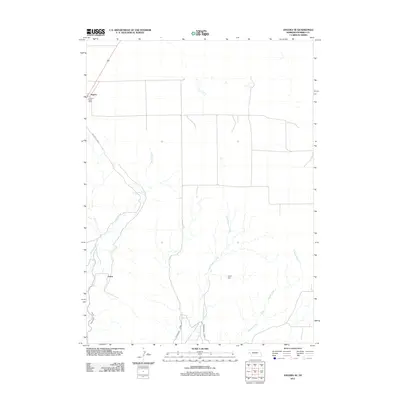
2011 Map of Angora SE
USGS Topo · Published 2011About this map
Agricultural infrastructure and water management define this portion of Morrill County, where the Northport Canal cuts through the western landscape to support local ranching and farming operations. The small settlement of Angora serves as a focal point in the northwest, home to the Angora Post Office, while the community of Vance sits further south. The terrain is etched by a series of intermittent waterways including Indian Creek, Upper Dugout Creek, and Bratten Creek, which drain toward the south and east. A significant man-made landmark, the Linch Dam, regulates water flow in the central portion of the quadrangle, illustrating the importance of irrigation systems in this high plains environment.
Find a feature on this map
8 named features on this map. Tap any name to fly to it.
Don’t see what you’re looking for? This feature index may not catch every label — zoom into the map to look around manually.
Map Details
Editions of this 2011 Angora SE Map
This is the sole edition of this map. No revisions or reprints were ever made.
Other maps of this area

1896 · Browns Creek
USGS Topo · 1:125,000

1898 · Camp Clarke
USGS Topo · 1:125,000

1899 · Browns Creek
USGS Topo · 1:125,000

1949 · Lynn
USGS Topo · 1:62,500

1954 · Scottsbluff
USGS Topo · 1:250,000

1958 · Scottsbluff
USGS Topo · 1:250,000

1965 · Bridgeport NW
USGS Topo · 1:24,000

1965 · Angora SE
USGS Topo · 1:24,000

1965 · Broadwater NW
USGS Topo · 1:24,000
1965 · Angora NE
USGS Topo · 1:24,000