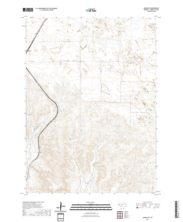
2021 Map of Angora SE
USGS Topo · Published 2021About this map
Angora sits at the northwestern edge of this Nebraska landscape, where the high plains meet a network of seasonal watercourses and man-made irrigation infrastructure. The map reveals the intricate water management essential to Morrill County, most notably the Northport Canal which skirts the western hills near the settlement of Vance. This area is defined by its drainage patterns, with Indian Cr and Upper Dugout Cr cutting through the terrain toward the south and east. Smaller water features like Linch Reservoir and Bratten Cr highlight the reliance on localized water storage and natural draws in an arid ranching and farming environment. The grid of section lines and rural roads, including Co Rd 118 and Co Rd 107, underscores the organized agricultural development of the region during the early 21st century.
Find a feature on this map
20 named features on this map. Tap any name to fly to it.
Don’t see what you’re looking for? This feature index may not catch every label — zoom into the map to look around manually.
Map Details
Editions of this 2021 Angora SE Map
This is the sole edition of this map. No revisions or reprints were ever made.
Other maps of this area

1896 · Browns Creek
USGS Topo · 1:125,000

1898 · Camp Clarke
USGS Topo · 1:125,000

1899 · Browns Creek
USGS Topo · 1:125,000

1949 · Lynn
USGS Topo · 1:62,500

1954 · Scottsbluff
USGS Topo · 1:250,000

1958 · Scottsbluff
USGS Topo · 1:250,000

1965 · Bridgeport NW
USGS Topo · 1:24,000

1965 · Angora SE
USGS Topo · 1:24,000

1965 · Broadwater NW
USGS Topo · 1:24,000
1965 · Angora NE
USGS Topo · 1:24,000