
1965 Map of Angora SE
USGS Topo · Published 1967About this map
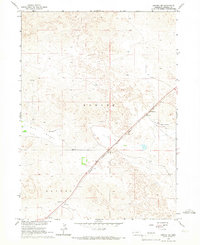
Camp Clarke and the surrounding high plains of Morrill County are documented here in the mid-1960s, showing a landscape defined by water management and transit. The Chicago Burlington and Quincy railroad cuts a diagonal path through the northwest, serving the small community of Angora and the siding at Vance. This era shows the critical infrastructure of the western Nebraska cattle and farming country, where the Northport Canal and siphons redirect water across a terrain marked by Upper Dugout Creek and Indian Creek. The map captures the transition between the flat tablelands of Haynes and the more broken country of Reilly Hill. Local history is preserved in small details like the lone Cem near the creek and a prominent Radio Tower that served as a modern landmark in this traditional ranching region.
Find a feature on this map
15 named features on this map. Tap any name to fly to it.
Don’t see what you’re looking for? This feature index may not catch every label — zoom into the map to look around manually.
Map Details
Editions of this 1965 Angora SE Map
This is the sole edition of this map. No revisions or reprints were ever made.
Other maps of this area

1896 · Browns Creek
USGS Topo · 1:125,000

1898 · Camp Clarke
USGS Topo · 1:125,000

1899 · Browns Creek
USGS Topo · 1:125,000

1949 · Lynn
USGS Topo · 1:62,500

1954 · Scottsbluff
USGS Topo · 1:250,000

1958 · Scottsbluff
USGS Topo · 1:250,000

1965 · Bridgeport NW
USGS Topo · 1:24,000

1965 · Broadwater NW
USGS Topo · 1:24,000
1965 · Angora NE
USGS Topo · 1:24,000
1965 · Angora NW
USGS Topo · 1:24,000