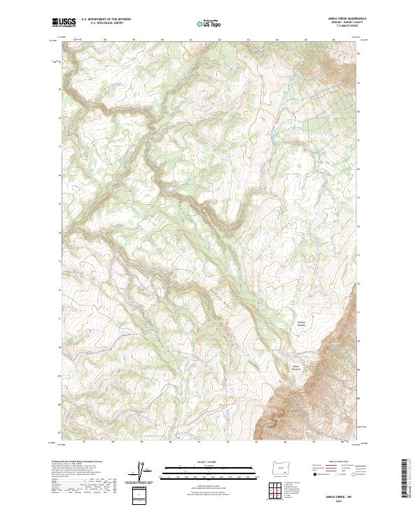
2023 Map of Ankle Creek
USGS Topo · Published 2023About this map
The Donner und Blitzen Wild and Scenic River corridor defines the northwestern reaches of this high-desert landscape in Harney County. This modern survey illustrates a rugged hydrological network where the Donner und Blitzen River is fed by numerous seasonal and perennial flows, including Ankle Creek, Mud Creek, and Scott Corral Creek. To the southeast, the terrain rises sharply toward the Steens Mountain Wilderness, dominated by the massive presence of Steens Mountain itself. The map reveals the essential nature of water in this arid environment, marking vital points such as Newton Spring, Joe Huff Spring, and the Public Waterhole. Cultural features are minimal, primarily consisting of the Mud Creek-Ankle Creek Trail and various range boundaries. The topography is dominated by significant elevations like Eusabio Ridge, which separates the drainage basins, and high-altitude features such as Penland Meadow.
Find a feature on this map
27 named features on this map. Tap any name to fly to it.
Don’t see what you’re looking for? This feature index may not catch every label — zoom into the map to look around manually.
Map Details
Editions of this 2023 Ankle Creek Map
This is the sole edition of this map. No revisions or reprints were ever made.
Other maps of this area

1955 · Adel
USGS Topo · 1:250,000

1957 · Adel
USGS Topo · 1:250,000

1958 · Adel
USGS Topo · 1:250,000

1962 · Adel
USGS Topo · 1:250,000

1968 · Tombstone Canyon
USGS Topo · 1:24,000

1968 · Fish Lake
USGS Topo · 1:24,000

1968 · Wildhorse Lake
USGS Topo · 1:24,000

1968 · Roaring Springs SE
USGS Topo · 1:24,000

1968 · Alvord Hot Springs
USGS Topo · 1:24,000

1968 · Ankle Creek
USGS Topo · 1:24,000