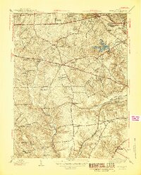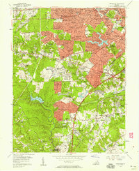
1956 Map of Annandale
USGS Topo · Published 1958About this map
Suburban expansion in Fairfax County defines this mid-century landscape as residential developments like Tremont Gardens and Devonshire Gardens emerge along major transit corridors. The Arlington Boulevard and Leesburg Pike intersection at Seven Corners serves as a focal point for this growth, while the Falls Church Airpark remains a visible remnant of local aviation history. To the south, the U S Military Reservation Fort Belvoir occupies significant acreage near the Fort Belvoir Reservoir, contrasting with the dense residential grids appearing in Weyanoke and Lincolnia. The map captures the area just before the full integration of the regional interstate system, showing the Shirley Memorial Highway as a primary artery connecting these burgeoning communities to the Alexandria city limits and the Southern Railway corridor.
Find a feature on this map
143 named features on this map. Tap any name to fly to it.
Don’t see what you’re looking for? This feature index may not catch every label — zoom into the map to look around manually.
Map Details
Editions of this 1956 Annandale Map
This is the sole edition of this map. No revisions or reprints were ever made.
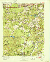
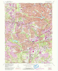
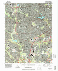
Historical Maps of Annandale Through Time
6 maps found