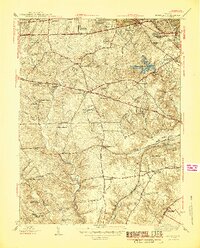
1945 Map of Annandale
USGS Topo · Published 1945About this map
Annandale and its surrounding Fairfax County neighborhoods are depicted here just after the war, showing a landscape defined by traditional crossroads and burgeoning suburban developments. Major transit arteries like Lee Boulevard, Gallows Road, and the Little River Turnpike connect established settlements such as Merrifield and Baileys Crossroads with newer residential tracts like Sleepy Hollow and Wakefield Forest. The terrain is deeply etched by watercourses including Accotink Creek and Holmes Run, which feeds into the Alexandria Reservoir.
Find a feature on this map
73 named features on this map. Tap any name to fly to it.
Don’t see what you’re looking for? This feature index may not catch every label — zoom into the map to look around manually.
Map Details
Editions of this 1945 Annandale Map
2 editions found
Other maps of this area

1890 · Mt. Vernon
USGS Topo · 1:125,000

1891 · Mt. Vernon
USGS Topo · 1:125,000

1894 · Mt. Vernon
USGS Topo · 1:125,000

1897 · Mt. Vernon
USGS Topo · 1:125,000

1900 · Washington
USGS Topo · 1:62,500

1913 · Indian Head
USGS Topo · 1:62,500

1915 · Fairfax
USGS Topo · 1:62,500

1923 · Indian Head
USGS Topo · 1:48,000

1925 · Indian Head
USGS Topo · 1:62,500

1927 · Quantico
USGS Topo · 1:62,500