
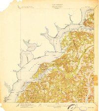
1913 Map of Indian Head
USGS Topo · Published 1913About this map
The Potomac River corridor south of Washington, D.C. reveals a landscape of strategic defense and river-based commerce in the early twentieth century. This 1913 edition shows the Naval Proving Grounds at Indian Head, a critical military facility established during the late nineteenth century. Across the river, the Virginia shoreline is deeply indented by Pohick Bay, Gunston Cove, and Occoquan Bay, defining the approach to the capital.
Find a feature on this map
97 named features on this map. Tap any name to fly to it.
Don’t see what you’re looking for? This feature index may not catch every label — zoom into the map to look around manually.
Map Details
Editions of this 1913 Indian Head Map
2 editions found
Other maps of this area

1889 · Fredericksburg
USGS Topo · 1:125,000

1890 · Mt. Vernon
USGS Topo · 1:125,000

1891 · Mt. Vernon
USGS Topo · 1:125,000

1892 · Fredericksburg
USGS Topo · 1:125,000

1892 · Brandywine
USGS Topo · 1:62,500

1894 · Wicomico
USGS Topo · 1:62,500

1894 · Fredericksburg
USGS Topo · 1:125,000

1894 · Mt. Vernon
USGS Topo · 1:125,000

1895 · Wicomico
USGS Topo · 1:62,500

1895 · Brandywine
USGS Topo · 1:62,500