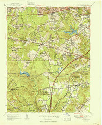
1951 Map of Annandale
USGS Topo · Published 1951About this map
Annandale and its surrounding suburban developments appear here in the early post-war era, showing the rapid transformation of Fairfax and Arlington County as neighborhoods like Jefferson Village, Sleepy Hollow, and Tremont Gardens began to fill the landscape. This period reveals a mixture of legacy rural landmarks and new infrastructure, where the Falls Church Airport and WFAX Radio Tower stand near established spiritual centers like Wakefield Chapel and Sydenstricker Chapel. The southern edge of the map is dominated by federal and military activity, including the U S Army Depot and the Coast Guard Radio Sta. The presence of the Southern Railway through Edsall and Springfield Sta highlights the rail corridor's influence on the area's development. Local water resources are well-defined by the Alexandria Reservoir and the Fort Belvoir Reservoir, both central to the region's expanding utility needs.
Find a feature on this map
112 named features on this map. Tap any name to fly to it.
Don’t see what you’re looking for? This feature index may not catch every label — zoom into the map to look around manually.
Map Details
Editions of this 1951 Annandale Map
2 editions found
Other maps of this area

1890 · Mt. Vernon
USGS Topo · 1:125,000

1891 · Mt. Vernon
USGS Topo · 1:125,000

1894 · Mt. Vernon
USGS Topo · 1:125,000

1897 · Mt. Vernon
USGS Topo · 1:125,000

1900 · Washington
USGS Topo · 1:62,500

1913 · Indian Head
USGS Topo · 1:62,500

1915 · Fairfax
USGS Topo · 1:62,500

1923 · Indian Head
USGS Topo · 1:48,000

1925 · Indian Head
USGS Topo · 1:62,500

1927 · Quantico
USGS Topo · 1:62,500