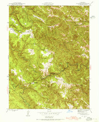
1943 Map of Annapolis
USGS Topo · Published 1956About this map
Stewarts Point Rancheria and the settlement of Annapolis anchor this mid-century look at the Sonoma County hinterlands. The landscape is defined by the complex branching of the North Fork Gualala River and the South Fork Gualala River, where the terrain is carved into distinct ridges such as John West Ridge and Miller Ridge. The mapping reveals a rural economy based on scattered agricultural holdings, including the Evans Ranch, Taber Ranch, and Noble Ranch.
Find a feature on this map
35 named features on this map. Tap any name to fly to it.
Don’t see what you’re looking for? This feature index may not catch every label — zoom into the map to look around manually.
Map Details
Editions of this 1943 Annapolis Map
2 editions found
Other maps of this area

1921 · Skaggs
USGS Topo · 1:62,500

1921 · Plantation
USGS Topo · 1:62,500

1938 · Hopland
USGS Topo · 1:62,500

1943 · Tombs Creek
USGS Topo · 1:24,000

1943 · Stewarts Point
USGS Topo · 1:24,000

1943 · Plantation
USGS Topo · 1:24,000

1943 · Annapolis
USGS Topo · 1:24,000

1943 · Fort Ross
USGS Topo · 1:24,000

1943 · Hopland
USGS Topo · 1:62,500

1943 · Ornbaun
USGS Topo · 1:62,500