
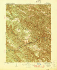
1944 Map of Annapolis
USGS Topo · Published 1944About this map
The Stewarts Point Rancheria and the settlement of Annapolis define this 1940s landscape in Sonoma County, where the complex drainage system of the Gualala River dictates the pattern of human activity. The map reveals a community structured around family ranching and early mountain industry, featuring several named holdings such as Olson Ranch, Gehrke Ranch, and Williams Ranch. The inclusion of a Shingle Mill near Clarks Crossing points to the timber-related labor that shaped this era, while Horicon Sch and the YMCA Camp mark the social and educational hubs of the remote area.
Find a feature on this map
45 named features on this map. Tap any name to fly to it.
Don’t see what you’re looking for? This feature index may not catch every label — zoom into the map to look around manually.
Map Details
Editions of this 1944 Annapolis Map
2 editions found
Other maps of this area

1921 · Skaggs
USGS Topo · 1:62,500

1921 · Plantation
USGS Topo · 1:62,500

1938 · Hopland
USGS Topo · 1:62,500

1943 · Tombs Creek
USGS Topo · 1:24,000

1943 · Stewarts Point
USGS Topo · 1:24,000

1943 · Plantation
USGS Topo · 1:24,000

1943 · Annapolis
USGS Topo · 1:24,000

1943 · Fort Ross
USGS Topo · 1:24,000

1943 · Hopland
USGS Topo · 1:62,500

1943 · Ornbaun
USGS Topo · 1:62,500