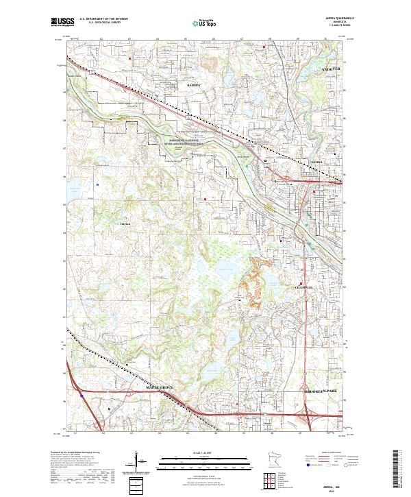
1955 Map of Anoka
USGS Topo · Published 1959About this map
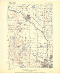
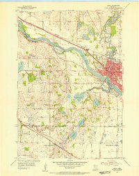
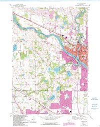
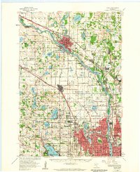
The Mississippi River serves as the central artery for this mid-century survey, dividing the landscape between Anoka and Hennepin counties as the post-war suburbs began their outward expansion. Substantial residential development is evident in Brooklyn Center, Crystal, and Robbinsdale at the southern edge, where dense street grids contrast with the still-open townships of Maple Grove and Brooklyn Park. The confluence of the Rum River and Mississippi at Anoka highlights the area's historic importance as a regional hub, anchored by the State Hospital and local industry.
Find a feature on this map
121 named features on this map. Tap any name to fly to it.
Don’t see what you’re looking for? This feature index may not catch every label — zoom into the map to look around manually.
Map Details
Editions of this 1955 Anoka Map
This is the sole edition of this map. No revisions or reprints were ever made.
Historical Maps of Nanterre Through Time
7 maps found