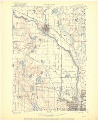
1902 Map of Anoka
USGS Topo · Published 1921About this map
The Rum River joins the Mississippi River at Anoka, marking a critical juncture of early transport and industry in the region at the beginning of the twentieth century. This survey reveals a landscape transitioning from rural townships like Dayton and Maple Grove into a connected metropolitan corridor. A dense network of rail lines, including the Great Northern R. R. and the Northern Pacific R. R., parallels the riverbanks, fueling the growth of riverside settlements like Champlin and Robbinsdale. To the south, the expanding City Bdy of Minneapolis pushes north toward Northtown and Columbia Heights. Between these hubs, the terrain is defined by an intricate system of glacial water bodies, from the large Medicine Lake and Eagle Lake to smaller features like Cedar Island Lake and Mud Lake, connected by drainage ways like Shingle Creek and Coon Creek.
Find a feature on this map
59 named features on this map. Tap any name to fly to it.
Don’t see what you’re looking for? This feature index may not catch every label — zoom into the map to look around manually.
Map Details
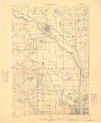
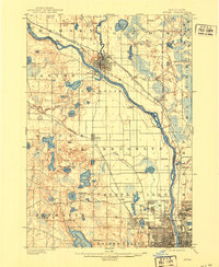
Editions of this 1902 Anoka Map
4 editions found
Other maps of this area

1896 · Minneapolis
USGS Topo · 1:62,500

1896 · St. Paul
USGS Topo · 1:62,500

1901 · Minneapolis
USGS Topo · 1:62,500

1902 · White Bear
USGS Topo · 1:62,500

1902 · Anoka
USGS Topo · 1:62,500

1905 · Minnetonka
USGS Topo · 1:62,500

1907 · Minnetonka
USGS Topo · 1:62,500

1909 · Rockford
USGS Topo · 1:62,500

1916 · St. Francis
USGS Topo · 1:62,500

1919 · St. Francis
USGS Topo · 1:62,500