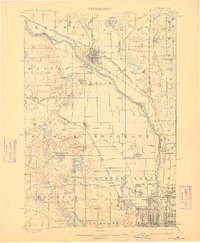
1902 Map of Anoka
USGS Topo · Published 1910About this map
The Rum River flows into the Mississippi at the heart of Anoka, which at the turn of the century served as a vital junction for the Northern Pacific R. R. and Great Northern R. R.. This 1899 survey captures the landscape of Hennepin and Anoka Counties before suburban expansion, showing a countryside defined by glacial lakes and small agricultural hubs. To the south, the early grid of Minneapolis begins to push northward through Robbinsdale and Northtown, while the outlying areas of Osseo and Champlin remain distinct rural settlements. A dense network of smaller water bodies, including Medicine Lake, Eagle Lake, and Rice Lake, dot the prairie and woodland, connected by early drainage features like Coon Creek and Shingle Creek. The map provides a look at the region's transition from a logging and milling economy toward an integrated rail-and-river network.
Find a feature on this map
74 named features on this map. Tap any name to fly to it.
Don’t see what you’re looking for? This feature index may not catch every label — zoom into the map to look around manually.
Map Details
Editions of this 1902 Anoka Map
4 editions found
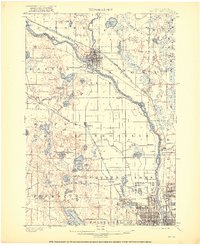
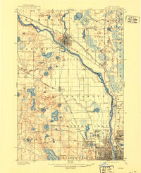
Other maps of this area

1896 · Minneapolis
USGS Topo · 1:62,500

1896 · St. Paul
USGS Topo · 1:62,500

1901 · Minneapolis
USGS Topo · 1:62,500

1902 · White Bear
USGS Topo · 1:62,500

1902 · Anoka
USGS Topo · 1:62,500

1905 · Minnetonka
USGS Topo · 1:62,500

1907 · Minnetonka
USGS Topo · 1:62,500

1909 · Rockford
USGS Topo · 1:62,500

1916 · St. Francis
USGS Topo · 1:62,500

1919 · St. Francis
USGS Topo · 1:62,500