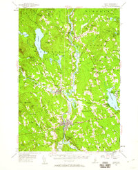
1955 Map of Anson
USGS Topo · Published 1960About this map
The Kennebec River corridor defines this mid-1950s landscape, serving as the industrial and transportation spine for Somerset County settlements. In the southern reach, the neighboring towns of Anson and Madison are linked by bridges over the river, with the Maine Central railroad providing a vital connection to the larger regional economy. To the north, the village of Solon sits near Arnold Landing, a name referencing the historic military route through the wilderness.
Find a feature on this map
101 named features on this map. Tap any name to fly to it.
Don’t see what you’re looking for? This feature index may not catch every label — zoom into the map to look around manually.
Map Details
Editions of this 1955 Anson Map
4 editions found

Other maps of this area

1892 · Waterville
USGS Topo · 1:62,500

1894 · Norridgewock
USGS Topo · 1:62,500

1898 · Norridgewock
USGS Topo · 1:62,500

1903 · Bingham
USGS Topo · 1:62,500

1904 · Anson
USGS Topo · 1:62,500

1905 · Bingham
USGS Topo · 1:62,500

1913 · Skowhegan
USGS Topo · 1:62,500

1924 · Farmington
USGS Topo · 1:62,500

1928 · Dead River
USGS Topo · 1:62,500

1930 · Kingfield
USGS Topo · 1:48,000