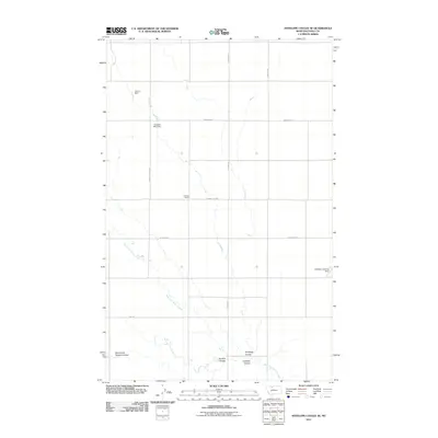
2011 Map of Antelope Coulee SE
USGS Topo · Published 2011About this map
Antelope Coulee defines the drainage patterns of this Toole County landscape, where the high plains of northern Montana are etched by seasonal waterways and local water management. The area is characterized by a network of ranch roads and small-scale hydraulic improvements, including the Cloakus Dam and the Crooked Man Dam along the northern reaches. These structures, alongside the West Fork Willow Creek, provide a record of how water has been harnessed in this semi-arid environment.
Find a feature on this map
17 named features on this map. Tap any name to fly to it.
Don’t see what you’re looking for? This feature index may not catch every label — zoom into the map to look around manually.
Map Details
Editions of this 2011 Antelope Coulee SE Map
This is the sole edition of this map. No revisions or reprints were ever made.
Other maps of this area

1920 · Conrad
USGS Topo · 1:125,000

1943 · Antelope Coulee
USGS Topo · 1:62,500

1954 · Shelby
USGS Topo · 1:250,000

1958 · Shelby
USGS Topo · 1:250,000

1962 · Hawthorne School
USGS Topo · 1:24,000

1962 · Mc Carters Lake
USGS Topo · 1:24,000

1967 · South Devon School
USGS Topo · 1:24,000

1967 · Dunkirk
USGS Topo · 1:24,000

1970 · Devon
USGS Topo · 1:24,000
1984 · Conrad
USGS Topo · 1:100,000