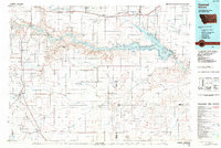
1984 Map of Conrad
USGS Topo · Published 1984About this map
The agricultural and prairie landscape of north-central Montana is defined here by the expansive waters of Lake Elwell and the Tiber Reservoir, where the Marias River was dammed to support regional irrigation. This 1984 map, compiled from earlier surveys and aerial photography, shows the critical transportation corridor of the Burlington Northern railroad as it passes through the high plains settlements of Shelby, Dunkirk, and Lothair.
Find a feature on this map
80 named features on this map. Tap any name to fly to it.
Don’t see what you’re looking for? This feature index may not catch every label — zoom into the map to look around manually.
Map Details
Editions of this 1984 Conrad Map
This is the sole edition of this map. No revisions or reprints were ever made.
Other maps of this area

1886 · Great Falls
USGS Topo · 1:250,000

1890 · Fort Benton
USGS Topo · 1:250,000

1892 · Fort Benton
USGS Topo · 1:250,000

1897 · Fort Benton
USGS Topo · 1:250,000

1909 · Cut Bank
USGS Topo · 1:125,000

1912 · Cut Bank
USGS Topo · 1:125,000

1919 · Alma
USGS Topo · 1:125,000

1920 · Choteau
USGS Topo · 1:125,000

1920 · Dupuyer
USGS Topo · 1:125,000

1920 · Conrad
USGS Topo · 1:125,000