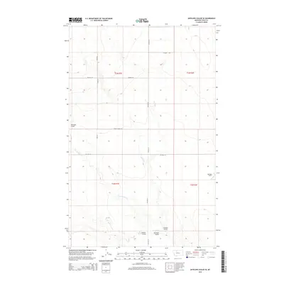
2014 Map of Antelope Coulee SE
USGS Topo · Published 2014About this map
Antelope Coulee and its neighboring ravines define the landscape of this Toole County region, where the high plains are carved by the intermittent flows of the W Fork Willow Cr. The map reveals a highly structured section-line road network, anchored by routes like Telstad Rd and Hagen Rd, which trace the boundaries of rural Montana townships. This 2014 survey documents the persistence of large-scale ranching and agriculture, indicated by landmarks such as Bennett Ranch Rd.
Find a feature on this map
16 named features on this map. Tap any name to fly to it.
Don’t see what you’re looking for? This feature index may not catch every label — zoom into the map to look around manually.
Map Details
Editions of this 2014 Antelope Coulee SE Map
This is the sole edition of this map. No revisions or reprints were ever made.
Other maps of this area

1920 · Conrad
USGS Topo · 1:125,000

1943 · Antelope Coulee
USGS Topo · 1:62,500

1954 · Shelby
USGS Topo · 1:250,000

1958 · Shelby
USGS Topo · 1:250,000

1962 · Hawthorne School
USGS Topo · 1:24,000

1962 · Mc Carters Lake
USGS Topo · 1:24,000

1967 · South Devon School
USGS Topo · 1:24,000

1967 · Dunkirk
USGS Topo · 1:24,000

1970 · Devon
USGS Topo · 1:24,000
1984 · Conrad
USGS Topo · 1:100,000