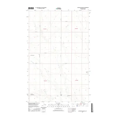
2017 Map of Antelope Coulee SE
USGS Topo · Published 2017About this map
The high plains of Toole County are defined here by a network of seasonal drainages and ranch roads during the late 2010s. The landscape is carved by deep geographic depressions including Antelope Coulee and Dunkirk Coulee, which shape the local topography. Water management is centered on the W Fork Willow Cr and the winding path of Crooked Coulee. This map reveals a sparsely populated agricultural region where transportation depends on a grid of gravel and dirt routes such as Telstad Rd, Jap Evans Rd, and Bennett Ranch Rd. In the eastern portion of the quadrangle, Hellinger Airport provides a rare landmark of modern infrastructure amidst the expansive terrain and the many forks of North Fork Dunkirk Coulee.
Find a feature on this map
19 named features on this map. Tap any name to fly to it.
Don’t see what you’re looking for? This feature index may not catch every label — zoom into the map to look around manually.
Map Details
Editions of this 2017 Antelope Coulee SE Map
This is the sole edition of this map. No revisions or reprints were ever made.
Other maps of this area

1920 · Conrad
USGS Topo · 1:125,000

1943 · Antelope Coulee
USGS Topo · 1:62,500

1954 · Shelby
USGS Topo · 1:250,000

1958 · Shelby
USGS Topo · 1:250,000

1962 · Hawthorne School
USGS Topo · 1:24,000

1962 · Mc Carters Lake
USGS Topo · 1:24,000

1967 · South Devon School
USGS Topo · 1:24,000

1967 · Dunkirk
USGS Topo · 1:24,000

1970 · Devon
USGS Topo · 1:24,000
1984 · Conrad
USGS Topo · 1:100,000