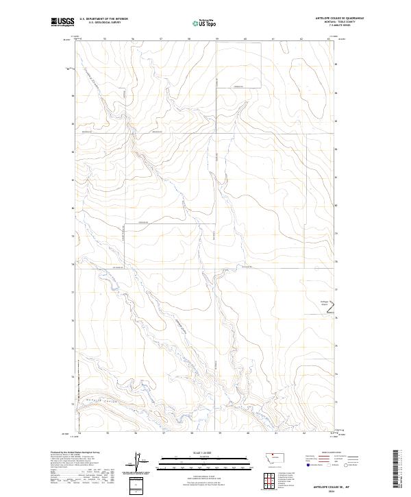
2024 Map of Antelope Coulee SE
USGS Topo · Published 2024About this map
Deep incisions of the northern Montana plains define this landscape, where the West Fork Willow Creek and Antelope Coulee carve through the open terrain of Toole County. The layout reflects the enduring grid of the Public Land Survey System, with township boundaries like t33n r1e and t32n r1e providing a framework for the region's ranching and agricultural operations. Small-scale aviation and local transport are central to the area's connectivity, anchored by the Hellinger Airport on the eastern edge of the quadrangle.
Find a feature on this map
16 named features on this map. Tap any name to fly to it.
Don’t see what you’re looking for? This feature index may not catch every label — zoom into the map to look around manually.
Map Details
Editions of this 2024 Antelope Coulee SE Map
This is the sole edition of this map. No revisions or reprints were ever made.
Other maps of this area

1920 · Conrad
USGS Topo · 1:125,000

1943 · Antelope Coulee
USGS Topo · 1:62,500

1954 · Shelby
USGS Topo · 1:250,000

1958 · Shelby
USGS Topo · 1:250,000

1962 · Hawthorne School
USGS Topo · 1:24,000

1962 · Mc Carters Lake
USGS Topo · 1:24,000

1967 · South Devon School
USGS Topo · 1:24,000

1967 · Dunkirk
USGS Topo · 1:24,000

1970 · Devon
USGS Topo · 1:24,000
1984 · Conrad
USGS Topo · 1:100,000