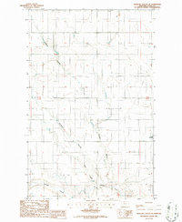
1986 Map of Antelope Coulee SE
USGS Topo · Published 1986About this map
The Toole County plains are defined here by a series of dramatic drainages and ephemeral water systems during the mid-1980s. The landscape is dominated by the meandering Antelope Coulee and Crooked Coulee, which carve through the high prairie alongside the West Fork Willow Creek. Evidence of the region's semi-arid nature is found in the scattered Alkali Flats and smaller Alkali Flat deposits that punctuate the low-lying terrain. Human infrastructure in this portion of the northern Montana interior is sparse, marked primarily by the isolated Hellinger Landing Strip and the winding course of Dunkirk Coulee in the southern reaches of the quadrangle. This 1986 provisional survey captures the intersection of large-scale ranching territory and the natural hydrological network before modern alterations, showing the township and range grid lines of T 32 N and T 33 N imposed over the breaks of the plains.
Find a feature on this map
9 named features on this map. Tap any name to fly to it.
Don’t see what you’re looking for? This feature index may not catch every label — zoom into the map to look around manually.
Map Details
Editions of this 1986 Antelope Coulee SE Map
This is the sole edition of this map. No revisions or reprints were ever made.
Other maps of this area

1920 · Conrad
USGS Topo · 1:125,000

1943 · Antelope Coulee
USGS Topo · 1:62,500

1954 · Shelby
USGS Topo · 1:250,000

1958 · Shelby
USGS Topo · 1:250,000

1962 · Hawthorne School
USGS Topo · 1:24,000

1962 · Mc Carters Lake
USGS Topo · 1:24,000

1967 · South Devon School
USGS Topo · 1:24,000

1967 · Dunkirk
USGS Topo · 1:24,000

1970 · Devon
USGS Topo · 1:24,000
1984 · Conrad
USGS Topo · 1:100,000