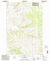
1996 Map of Antelope Creek
USGS Topo · Published 1998About this map
The John Long Mountains define this high-altitude landscape within the Deerlodge National Forest during the mid-1990s. The topography is dominated by steep drainage systems, most notably Antelope Creek and Upper Willow Creek, which carve deep through the timbered terrain. Traces of historical mineral exploration are evident throughout the map, with several marked mines and a specific Mines Prospect located near the headwaters of Bethany creek.
Find a feature on this map
22 named features on this map. Tap any name to fly to it.
Don’t see what you’re looking for? This feature index may not catch every label — zoom into the map to look around manually.
Map Details
Editions of this 1996 Antelope Creek Map
This is the sole edition of this map. No revisions or reprints were ever made.
Other maps of this area

1908 · Philipsburg
USGS Topo · 1:125,000

1909 · Sapphire
USGS Topo · 1:125,000

1947 · Butte
USGS Topo · 1:250,000

1958 · Butte
USGS Topo · 1:250,000

1960 · Butte
USGS Topo · 1:250,000

1962 · Butte
USGS Topo · 1:250,000

1971 · Henderson Mountain
USGS Topo · 1:24,000

1971 · Georgetown Lake
USGS Topo · 1:24,000

1971 · Antelope Creek
USGS Topo · 1:24,000

1971 · Potato Lakes
USGS Topo · 1:24,000