
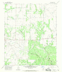
1962 Map of Antelope Creek SW
USGS Topo · Published 1965About this map
The rugged West Texas landscape of the Haskell Co Throckmorton Co border comes alive in this early 1960s survey, defined by the winding course of Millers Creek and its many tributaries. The area is marked by a network of drainage systems including Wild Horse Creek, Bow Creek, and the prominent Gobbler Branch. This map documents a transitional period for the region's energy economy, capturing the Swenson Oil Field in the southeastern quadrant along with scattered individual Oil Wells and a significant Pipeline corridor. The presence of a Gaging Sta on Millers Creek underscores the importance of water monitoring in this arid terrain. The landscape is further dissected by numerous dry washes and named canyons such as Spring Hollow, revealing the intricate topography that dictated local ranching and industrial development.
Find a feature on this map
17 named features on this map. Tap any name to fly to it.
Don’t see what you’re looking for? This feature index may not catch every label — zoom into the map to look around manually.
Map Details
Editions of this 1962 Antelope Creek SW Map
This is the sole edition of this map. No revisions or reprints were ever made.
Other maps of this area

1954 · Wichita Falls
USGS Topo · 1:250,000

1958 · Wichita Falls
USGS Topo · 1:250,000

1962 · Antelope Creek SE
USGS Topo · 1:24,000

1962 · Antelope Creek NE
USGS Topo · 1:24,000

1962 · Antelope Creek NW
USGS Topo · 1:24,000

1965 · Reynolds Bend NW
USGS Topo · 1:24,000

1966 · Tonk Creek
USGS Topo · 1:24,000
1966 · Irby
USGS Topo · 1:24,000

1967 · Mattson
USGS Topo · 1:24,000
1968 · Munday East
USGS Topo · 1:24,000