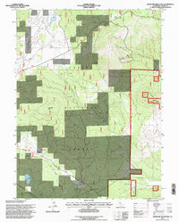
1995 Map of Antelope Mountain
USGS Topo · Published 1997About this map
Lassen National Forest terrain dominates this mid-1990s survey, defined by the volcanic topography of Antelope Mountain and Fox Mountain. The landscape is a mix of high-elevation peaks and expansive open areas like Pine Creek Valley and Merrill Flat. A notable piece of industrial history is found in the southwest, where an Old Railroad Grade winds through the forest toward Mud Lake, indicating the region’s earlier reliance on timber transport or rail-linked resource extraction.
Find a feature on this map
27 named features on this map. Tap any name to fly to it.
Don’t see what you’re looking for? This feature index may not catch every label — zoom into the map to look around manually.
Map Details
Editions of this 1995 Antelope Mountain Map
This is the sole edition of this map. No revisions or reprints were ever made.
Other maps of this area

1886 · Honey Lake
USGS Topo · 1:250,000

1886 · Lassen Peak
USGS Topo · 1:250,000

1891 · Honey Lake
USGS Topo · 1:250,000

1892 · Lassen Peak
USGS Topo · 1:250,000

1893 · Honey Lake
USGS Topo · 1:250,000

1894 · Lassen Peak
USGS Topo · 1:250,000

1939 · Halls Flat
USGS Topo · 1:125,000

1955 · Westwood
USGS Topo · 1:62,500

1955 · Westwood
USGS Topo · 1:250,000

1956 · Chester
USGS Topo · 1:62,500