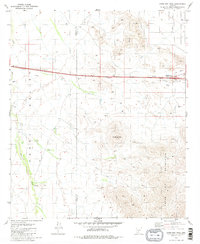
1981 Map of Antelope Peak
USGS Topo · Published 1981About this map
Antelope Peak stands as the central landmark of this desert landscape, where the arid Vekol Valley meets the high elevations of the Table Top Mountains. The map documents a rugged environment defined by seasonal drainages like Vekol Wash and Antelope Wash, which carve through the terrain. Human activity is largely concentrated along the modern transportation corridor, marked by the Hidden Valley Interchange and roadside Rest Area facilities. Away from the highway, signs of ranching and exploration are visible in the form of a Corral and an isolated Prospect high in the mountains. This 1981 survey by the U.S. Geological Survey reveals the transition from valley floor to the rising peaks of the Maricopa and Pinal county border, captured just as modern infrastructure began to cross this section of the Sonoran desert.
Find a feature on this map
13 named features on this map. Tap any name to fly to it.
Don’t see what you’re looking for? This feature index may not catch every label — zoom into the map to look around manually.
Map Details
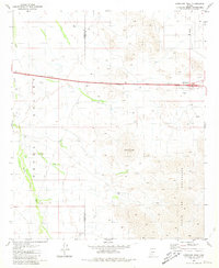
Editions of this 1981 Antelope Peak Map
2 editions found
Other maps of this area

1941 · Vekol Mountains
USGS Topo · 1:62,500

1942 · Vekol Mountains
USGS Topo · 1:62,500

1946 · Antelope Peak
USGS Topo · 1:62,500

1948 · Antelope Peak
USGS Topo · 1:62,500

1951 · Estrella
USGS Topo · 1:62,500

1953 · Ajo
USGS Topo · 1:250,000

1957 · Ajo
USGS Topo · 1:250,000

1958 · Ajo
USGS Topo · 1:250,000

1958 · Kaka
USGS Topo · 1:62,500

1962 · Ajo
USGS Topo · 1:250,000