
1932 Map of Antelope Plain
USGS Topo · Published 1932About this map
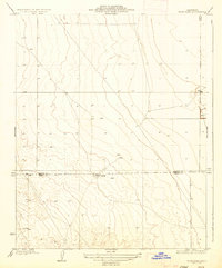
Antelope Plain occupies this 1932 topographic survey, which reveals a landscape in the midst of early 20th-century petroleum development. While much of the terrain is defined by the subtle, rhythmic contours of the valley floor, the mapping indicates active resource extraction through labels for Oil and several scattered Well sites. These markers underscore the area's transition from open range to an industrializing oil field in Kern County. The presence of these wells, surveyed shortly after the California oil boom, provides a precise record for researchers tracing the early infrastructure and lease patterns of the San Joaquin Valley’s western edge before modern consolidation and technology altered the surface character of the plain.
Find a feature on this map
3 named features on this map. Tap any name to fly to it.
Don’t see what you’re looking for? This feature index may not catch every label — zoom into the map to look around manually.
Map Details
Editions of this 1932 Antelope Plain Map
This is the sole edition of this map. No revisions or reprints were ever made.
Other maps of this area

1914 · Lost Hills
USGS Topo · 1:125,000

1930 · Avenal Gap
USGS Topo · 1:31,680

1932 · West of Goose Lake
USGS Topo · 1:31,680

1932 · Reynolds Ranch
USGS Topo · 1:31,680

1932 · West Camp
USGS Topo · 1:31,680

1932 · Lone Tree Well
USGS Topo · 1:31,680

1933 · Avenal Gap
USGS Topo · 1:31,680

1934 · West of Goose Lake
USGS Topo · 1:31,680
1935 · West Camp
USGS Topo · 1:31,680
1936 · Lone Tree Well
USGS Topo · 1:31,680