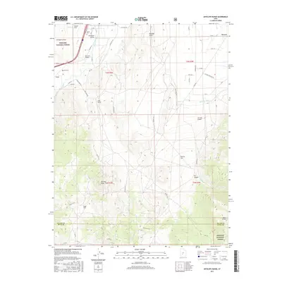
2017 Map of Antelope Range
USGS Topo · Published 2017About this map
The Sevier River and the Sevier Valley Canal define the agricultural life of this valley, where the small settlements of Monroe and Cove sit at the base of rising highlands. This 2017 study illustrates the complex irrigation network necessary for high-desert farming, including the Bertlesen Ditch and numerous unnamed channels that draw from the river. To the west, the Fishlake National Forest encompasses the high peaks of the Antelope Range, while the lower basins of Antelope Valley and Poverty Flat show the transition from cultivated fields to arid terrain. Family history markers are prominent along the valley floor, specifically the Joseph Cem and the Sevier Cems. The map also traces the industrial and recreational access to the backcountry via routes like Vca Mine Rd and Monroe Mtn Rd, as well as the geothermal activity at Hot Springs near the Sevier County and Piute County line.
Find a feature on this map
54 named features on this map. Tap any name to fly to it.
Don’t see what you’re looking for? This feature index may not catch every label — zoom into the map to look around manually.
Map Details
Editions of this 2017 Antelope Range Map
This is the sole edition of this map. No revisions or reprints were ever made.
Other maps of this area

1885 · Beaver
USGS Topo · 1:250,000

1932 · Sevier
USGS Topo · 1:62,500

1935 · Sevier
USGS Topo · 1:62,500

1937 · Delano Peak
USGS Topo · 1:48,000

1940 · Monroe
USGS Topo · 1:62,500

1943 · Delano Peak
USGS Topo · 1:62,500

1944 · Monroe
USGS Topo · 1:62,500

1945 · Marysvale
USGS Topo · 1:62,500

1947 · Marysvale
USGS Topo · 1:62,500

1953 · Richfield
USGS Topo · 1:250,000